There are no active watches, warnings or advisories
| Weather Data | |||
|---|---|---|---|
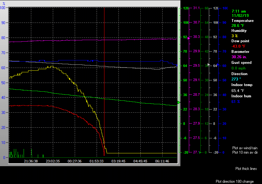
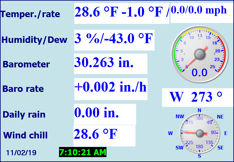
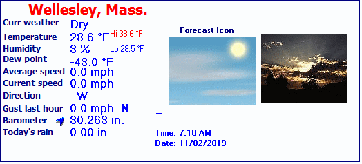
| LAST READING AT TIME: 7:10 AM DATE: November 02 2019, time of next update: 7:11 am | |||
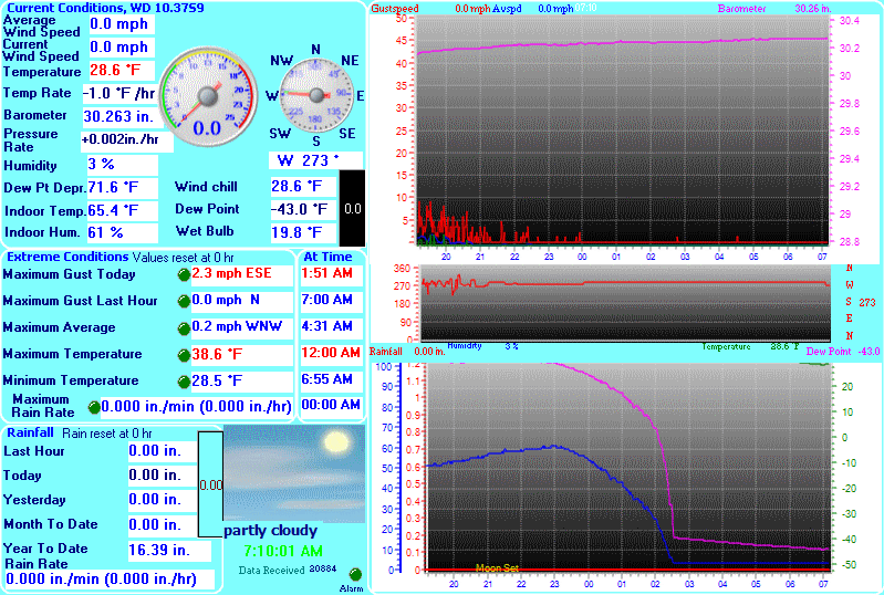
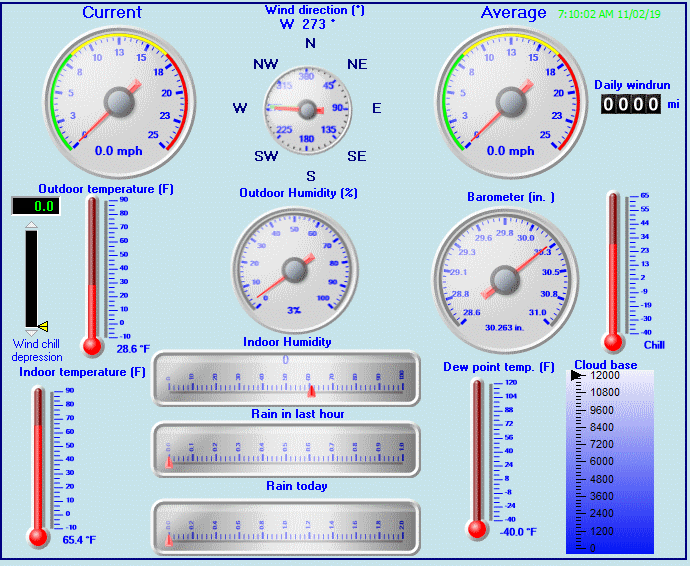
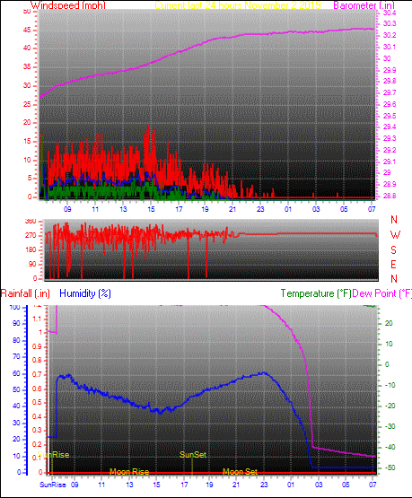
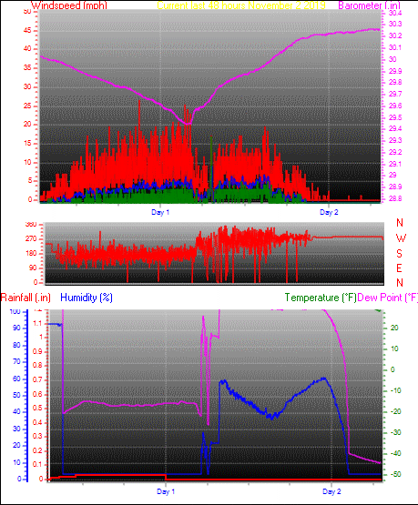
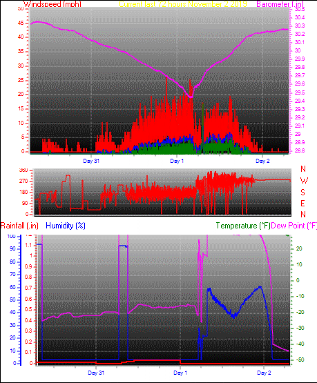
| Current Weather | Dry | Current Temperature | 28.6°F (-1.9°C), Apparent temp 23.7°F |
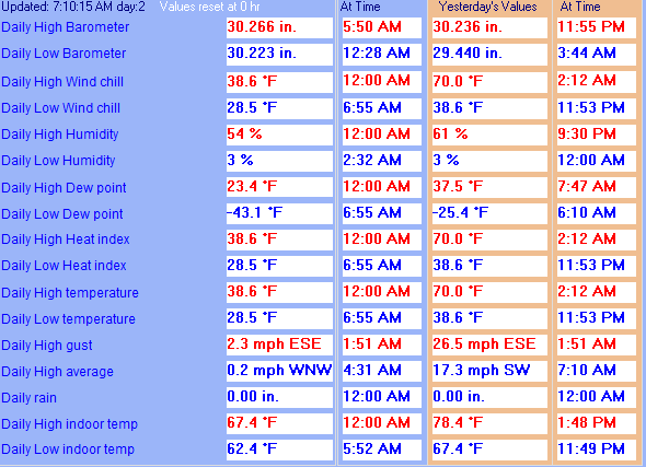
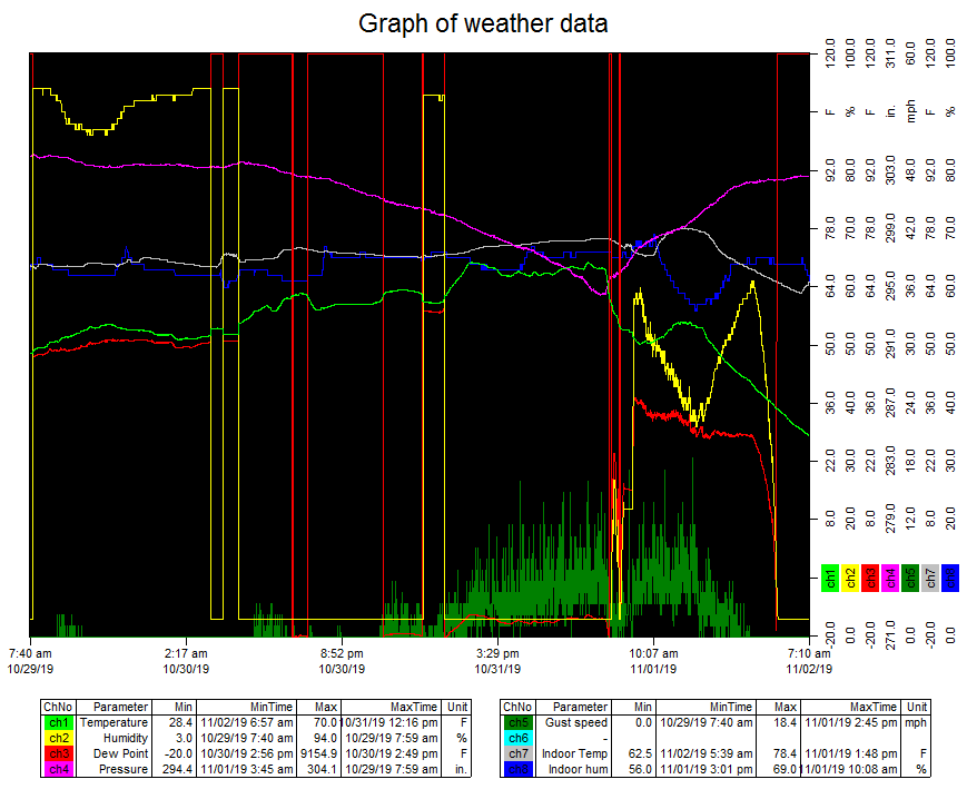
| Maximum Temperature (since midnight) | 38.6°F at: 12:00 AM | Minimum Temperature (since midnight) | 28.5°F at: 6:55 AM |
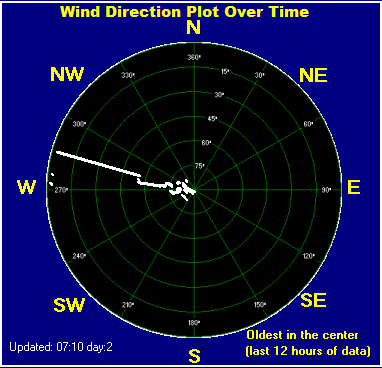
| Average windspeed (ten minute) | 0.0 mph | Wind Direction (ten minute) | W (274°) |
| Windchill Temperature | 28.6°F | Maximum Gust (last hour) | 0.0 mph at: 7:00 AM |
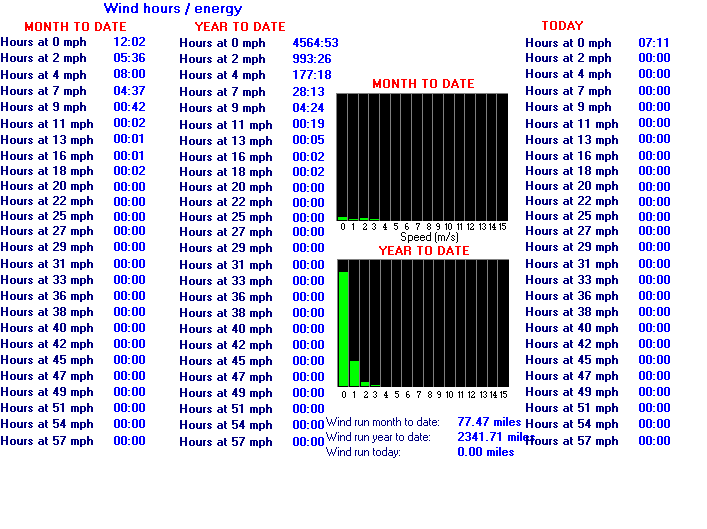
| Maximum Gust (since midnight) | 2.3 mph at: 1:51 AM | Maximum 1 minute average (since midnight) | 0.2 mph at: 4:31 AM |
| Rainfall (last hour) | 0.00 in. (0.0 mm) | Rainfall (since midnight) | 0.00 in. (0.0 mm) --- |
| Rainfall This month | 0.00 in. (0.0 mm) | Rainfall To date this year | 16.39 in. (416.2 mm) |
| Maximum rain per minute (last hour) | 0.00 in/min | Maximum rain per hour (last 6 hours) | 0.00 in/hour |
| Yesterdays rainfall | 0.00 in | DewPoint | -43.0°F (Wet Bulb :19.8°F ) |
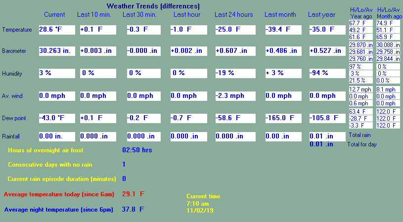
| Humidity | 3 %, Humidex 18.8°F | Barometer corrected to msl | 30.263 in. (1024.8 hPa) |
| Pressure change | 0.00 in. (last hour) | Trend (last hour) | STEADY |
| Pressure change (last 12 hours) | +0.11 in | Pressure change (last 6 hours) | +0.02 in |